Original Goals:
- To create an experience that makes park-goers feel amusement and delight.
- To create a mixing of regulars, tourists, and those who are wandering through the park, with possibly a focus on those who are just crossing through
- To invite park visitors/people passing by to feel a sense of belonging
Additional Goals:
- To encourage people to express themselves freely
- To engage park visitors to feel ownership for their favorite spot
- To CrowdSource map of the park (similar to an analog Foursquare)
Original Parameters:
- We will not cause annoyances to park goers
- We will not obstruct anyone’s general path
- In labeling and identification, we will not stereotype any region of the park
- We will not create noise that overpowers the general ambiance of the park’s various pockets
- Take a photo or plan of the location that you are working in and highlight the spaces that you are activating.
2nd Prototype Installation at SVA IxD floor:
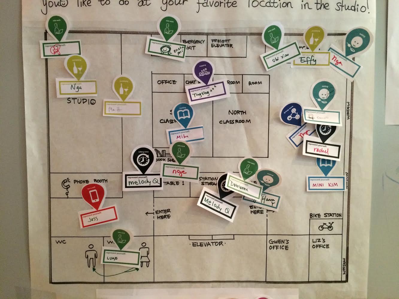
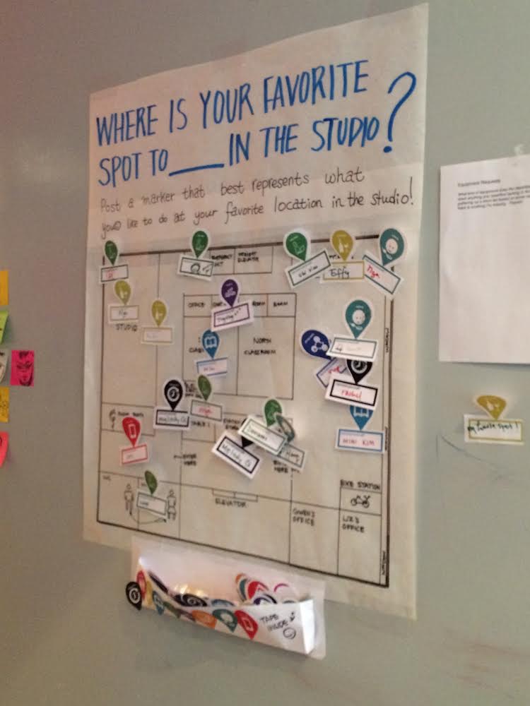
Prompt, Floor plan, and Activity icons (Killing time, Restroom, Socializing, Reading, Solo work, Napping, Class, Eating, On a call)
- First set up your second iteration at SVA IXD floor let it run for at least 24 hours, ideally 48.
We Installed on Monday, November 3rd, 2014 till Sunday, November 9th. (6 days)
2. Set it up at the actual location and document
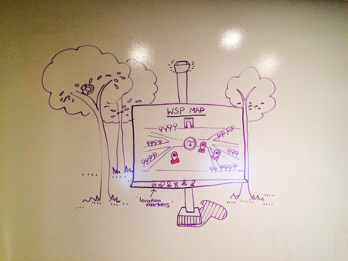
A 64 x 48 in foamcore setup of the Washington Square Park Map (Map is draw on a separate sheet) We’ll have thumbtacks and markers (some with iconography, some blank) to accomodate various levels of engagement and participation. We will keep it unattended, with a prompt that allows the user to read and participate on their own volition. We will keep the map at 3 different locations for 15-20 minutes each.
3.Write an analysis of your findings
- 21 location markers
- 6 Solo work
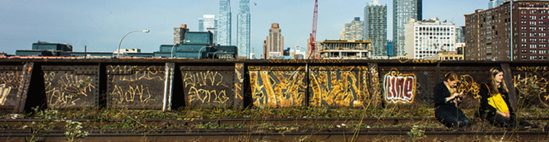
- 4 Socializing (3 at SVA IXD, 1 at outside of IXD)
- 3 Killing time
- 3 Eating
- 2 Reading
- 1 Group work
- 1 Sleeping
- 1 On a call
- Women were more participatory than men
- There might be a need for a reward for more active participation – or a sense of achievement. We will explore this further when we convert our analog prototype into a digital vision.
- We may need a better way to encourage people to express themselves in a creative way. The previous iteration, when people drew directly on the paper in a “freestyle” mode, they were more graphically expressive, drawing caricatures of themselves, etc. In our current prototype, because we created iconography of various activities, people were more likely to write their name rather than draw anything in the “represent yourself” box. It also resembled a name tag (as a rectangle form).
- We have to consider what happens when a popular area gets overlapped – How will everyone be visible when we have a higher density (high traffic)? Clusters? Number counts? Data viz?
- Frequency and change over time (in a day, in a week, in an hour, in a certain season?)
- We will also incorporate this map into a wayfinding digital vision (where live data and sensors could possibly impact and change a park-goer’s direction by suggestions)
- We yet don’t know how color plays a role.
Nice work!
What is the reward for participating?
Is the map itself the final output or is there another location that expresses the collective composition of peoples responses? I would like to see the documentation of the actual setup, it sounds great.
I would like you to think do a little blue sky thinking; what would you do if you had $1M? How could you employ technology in this design? What are the hours of this installation? Is it permanent?
-Michael